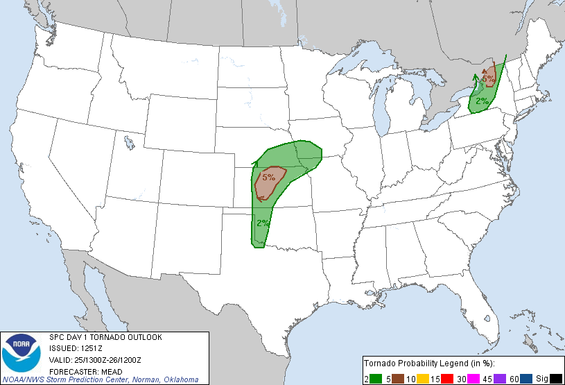
Warm and humid conditions are present in the eastern part of the country in advance of a cold front that is currently moving through southern ontario. A weak line of isolated thunder showers has set up along it, but it will intensity as it moves into Eastern Ontario and southern Quebec. A squall line with strong thunderstorms will develop along with strong winds, frequent lighting, hail and even maybe an isolated tornado. Here are the risk areas the SPC has put out (this would include an area that contains Montreal and Ottawa):
There is even a 5% risk for tornadoes, keep your eyes out in the Montreal area:
The 13Z HRRR is really showing the rapid intensification of this line of storms. This is due to the high dew points (in the 60's) and relative humidity, along with the front which gets the air to move upwards in one direction causing convection and the development of strong storms:
High CAPE values will help contribute to the rapid intensification of thunderstorms along this line. This will be partly caused by the surge of heat out in front and the sun coming out. Also VIL values are high enough to support hail in some of these cells:
The higher Storm Relative Energy Helicity Values gives the potential for some isolated tornadoes to form. This is a measure of shear in the atmosphere capable of making some cells rotate. Values between 150 and 300 usually indicate the potential for weak to moderate tornadoes:


No comments:
Post a Comment