
From this we can infer that a trough will move into the east between the 20th and 25th of october. Despite all of this the 06z GFS keeps the trough in the west and more ridging in the east.

Something doesn't look right here especially considering that the long term AO/NAO are going negative. I think blocking is going to develop like the GFS shows but the trough will progress further east into the great lakes, northeast and the ridge in Western Alaska will be centred further east in the GOA.
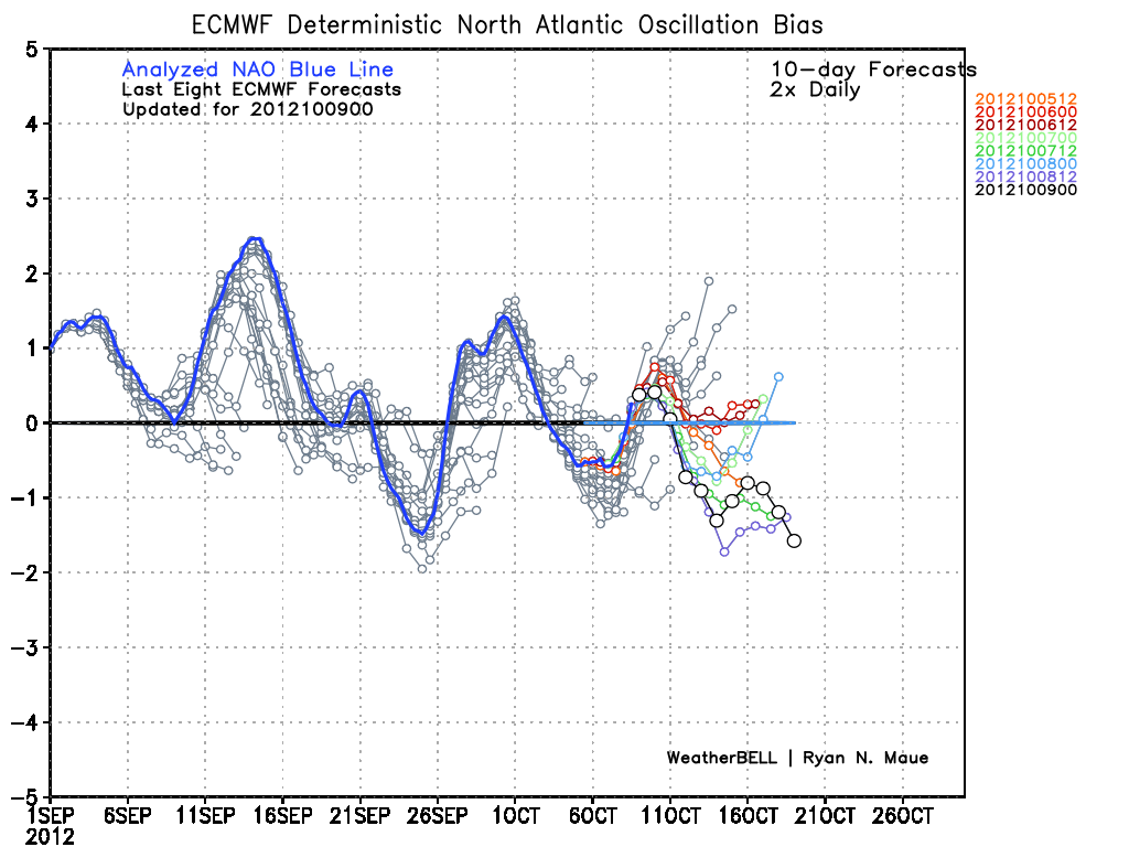

The european weeklies show this cool down across the east during this time period. This may set the stage for what I believe will be a colder then normal start to november.
No comments:
Post a Comment