Looks like a very interesting time period coming up with a crash in the AO and NAO as well as a trend towards a positive PNA. It looks like the models are having a bit of trouble deciding how to handle the energy between the STJ, polar jet and pacific jet. It looks like the potential for phasing is there and cold air will be able to get involved. 2 storms are actually depicted on the current runs of the GFS which is a sign that the pattern is favourable for major storm development for an extended period of time. The pattern trend tells me a major snow storm or two is in store for the end of november and beginning of december time period somewhere in the eastern two thirds of North America. Interesting times ahead, especially once more models start getting a better idea of what might occur. One major storm will effect the eastern seaboard between the 17th and 19th of november which i warned was going to happen last friday. A second storm looks to effect areas further west around the great lakes area which will occur between the 21st and 23rd of november i believe. 18z GFS keeps our storm separate from the east coast storm in the 17th-19th timeframe. This causes a stronger storm to cut up towards the great lakes. I still think GFS is under doing precipitation amounts and extent of the cold air at this range. Until the energy from this timeframe can get sampled and the storm goes into the higher resolution range a high degree of uncertainty is present right now. Also when it gets into the shorter range we can see more of a variety of opinion from other modelling outside of the gfs.

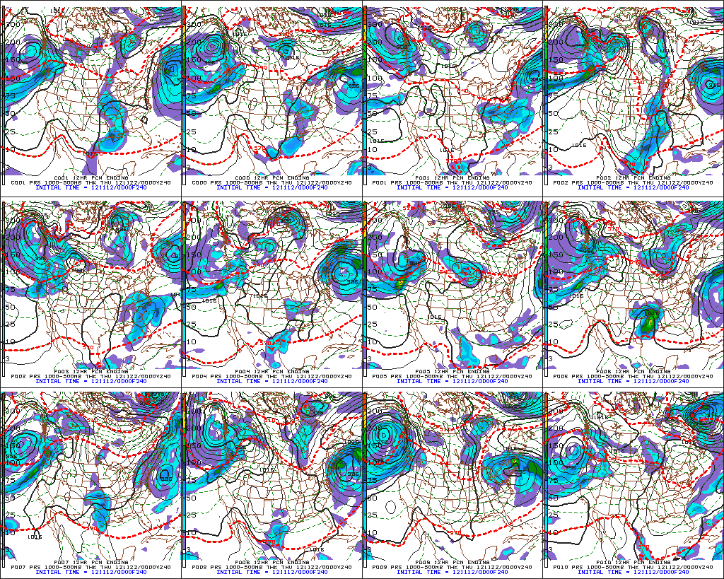
Heres are the morning and afternoon runs of the GFS ensembles with a trend to the west with the storm effecting the great lakes area.
0z:

12z:
Very interesting times ahead for the end of november and first few weeks of december with a very active pattern in the east and a major cold shot to end the month and set the stage for winter.
No comments:
Post a Comment